|
Rock climbing in the Dolomites, Italy. The 5 fingers traverse on the Fünffingerspitzen - Punta Delle Cinque Dita: Back to the General Dolomites information |
Other routes in the dolomites |
|
A very well known and popular alpine rock climbing route that spreads over 22 pitches (including traverses and some rappels) for a total of approximately 600 meters (1800 feet) of climbing, traversing and abseiling. Grade IV General: Unfortunately, this route is popular and the rock is good; avoid doing like we did and climbing it on a beautiful summer Sunday morning. We counted approximately 12 teams on the route and we missed some that started later in the day. A wise decision is to take the first lift up (08h15, I think) and be one of the first to climb (of course avoiding the crowds is easier during weekdays and non summer holiday season). Protection: This is a mountain route, and definitively not a sports route. The relays have usually 1 piton, rarely 2 (and can get crowded), some pitons will be found on the route (mainly on the thumb), but do not count on them being where you would like them to be. A number of slings and a rack of nuts at the least are necessary, unless you thrive on really long run outs. Access: From the Sellajochhaus (500m on the Val Gardena side of the Passo di Sella) either walk up to the top of the lift (Telecabine del Sassolungo, an interesting 2 people standing cabin) (1 hour) to the Langkofelscharte (Demetz Hut), or take the lift itself (15 min.). Route:
The summit of the Thumb is not too big (as all the relay points, not too many people can be there at the same time). Here the guidebook suggests to down climb 40 m to an rappel point from where 2 rappels will bring you down into the notch between the Thumb and the Index. From this point it is possible to finish off and return to the Langkofelscharte (top station of the lift where you started from). This descent is described a bit lower. We did not do the rest of the traverse, but it continues up the other side of the notch, index finger to the middle finger (highest point) and then goes down and traverses through the ring finger and little finger for another 9 or 10 pitches. Descending from the Notch between the Thumb and the Index: Although a popular exit point from the whole traverse, the whole descent is not obvious and very hard to find if you have never been there before. From the bottom of the second rappel from the Thumb, climb down the gully towards the lift for about 10 m to an anchor (right side of the gully). From there on the left side (facing towards the lift) a traverse follows a crack for about 15-20m (3 bolts or pitons) around a corner, where on top of a big slab stands a big anchor for rappelling. Rappel to the bottom of the slab (about 40m) From there follow the path and, more useful, the cairns (stone piles) along the front face, angling towards the left. The top of the last 3 rappels is very hard to find (even with the cairns being all around in the area). The last 2 rappels are quite easy to find (the last one lies at the top of a crack to the left (when facing the hut) of a pretty wide terrace), and bring you back right next to the top of the lift where the waiters of the hut will be more than happy to serve you some fresh, cold, well deserved beers. Then you can either walk (if not too drunk) or take the lift back down to the parking lot. Plan 3-4 hours for the Thumb and descent and 5-6 hours for the whole traverse plus 1 hour for the descent. More pitcures from the Index and summit of the Middle finger. The guidebook we used is the translation of a popular German guidebook:
Remember that the information provided here is as is and can contain mistakes. The author makes no warranties as of the exactitude of the information provided on this web page. Read our disclaimer
|
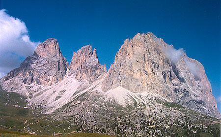 The 5 fingers (center) |
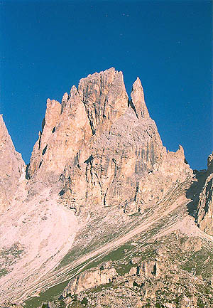 a close up |
|
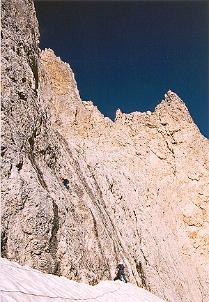 First pitch |
|
 Second pitch |
|
 First and second pitch |
|
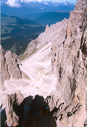 Looking backside from the 3rd pitch |
|
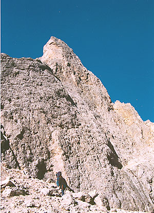
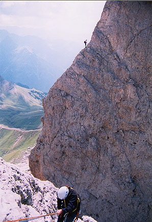
 Top of pitch 4 |
|
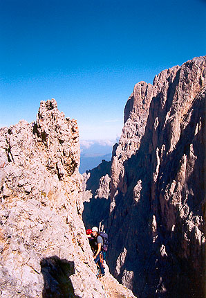
 Looking up pitch 7 |
|
 Looking up pitch 9 |
|
 Rappelling between the Thumb and the Index. |
|
 The route as it is on a photo |
|
 A close up of the route for the 2 first pitches |